
Bicaz Gorge & Red Lake: Romania's Wild Canyon Drive
Bicaz Gorge and Lacu Rosu in one drive: 8 km of ravine on DN12C, a lake made by a landslide in 1837, the 10 lei park ticket and 2026 road status.
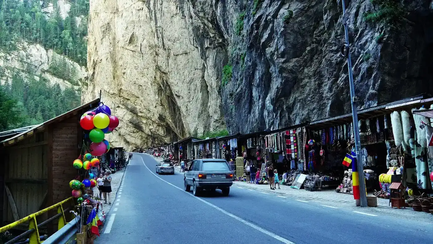
Bicaz Gorge and Lacu Rosu are one stop, not two. Eight kilometres of limestone ravine cut by the Bicaz river, a road threaded along the bottom of it, and a lake at the top end that a landslide made in 1837: you can drive the lot in half an hour, or give it a day and actually see it. The gorge straddles the Neamt and Harghita county line, which is also the old frontier between Moldavia and Transylvania, so most people cross it on the way somewhere else rather than as a day trip.
There is no scenic overlook here, and that single fact rearranges the whole visit. DN12C runs along the floor of the ravine, so you either look up through the windscreen at 30 km/h or you park badly and walk in the roadway with cars squeezing past your elbow. Everything worth seeing happens at walking pace, and the ninety minutes most itineraries allow are enough only if you’ve already worked out where to stop.
What the drive actually looks like
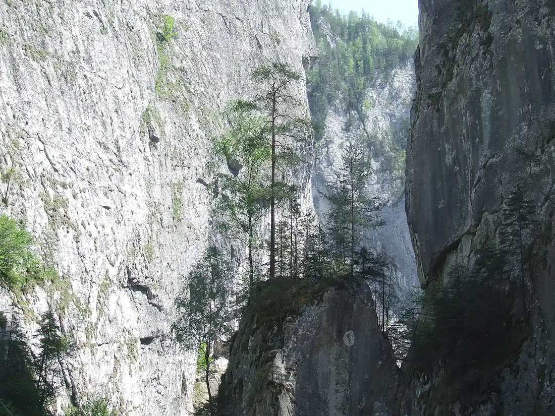
The gorge proper is 8 km of ravine. The road that uses it, DN12C, covers 10.8 km between Lacu Rosu and Bicaz Chei, all of it paved, with a dozen hairpins and one tunnel near the lake end. That tunnel is younger than it looks: 155 metres, opened in May 2005 on a line shifted about 45 metres upstream so traffic could keep running while it went up. The narrow bore alongside is the one it replaced, 68 metres hacked out of a natural cave in 1918 and never lined. The white limestone stands over 300 metres above the carriageway, and in the section called Gatul Iadului, the Throat of Hell, the gap narrows until the sky is a strip.
Both sides belong to Cheile Bicazului-Hasmas National Park, 7,072 hectares declared in 1990 and rising to Hasmasul Mare at 1,792 metres. It is not free to visit, whatever most write-ups say: the administration’s approved 2026 tariff is 10 lei for adults and children over 14 and 5 lei for under-14s, sold through the park’s own website. DN12C is a public national road with no barrier across it, so the ticket buys you the park rather than the drive. Bears, lynx, wolves and red deer live up there, along with golden eagles, capercaillie and three-toed woodpeckers, though from the road what you’ll actually see is a great many parked cars.
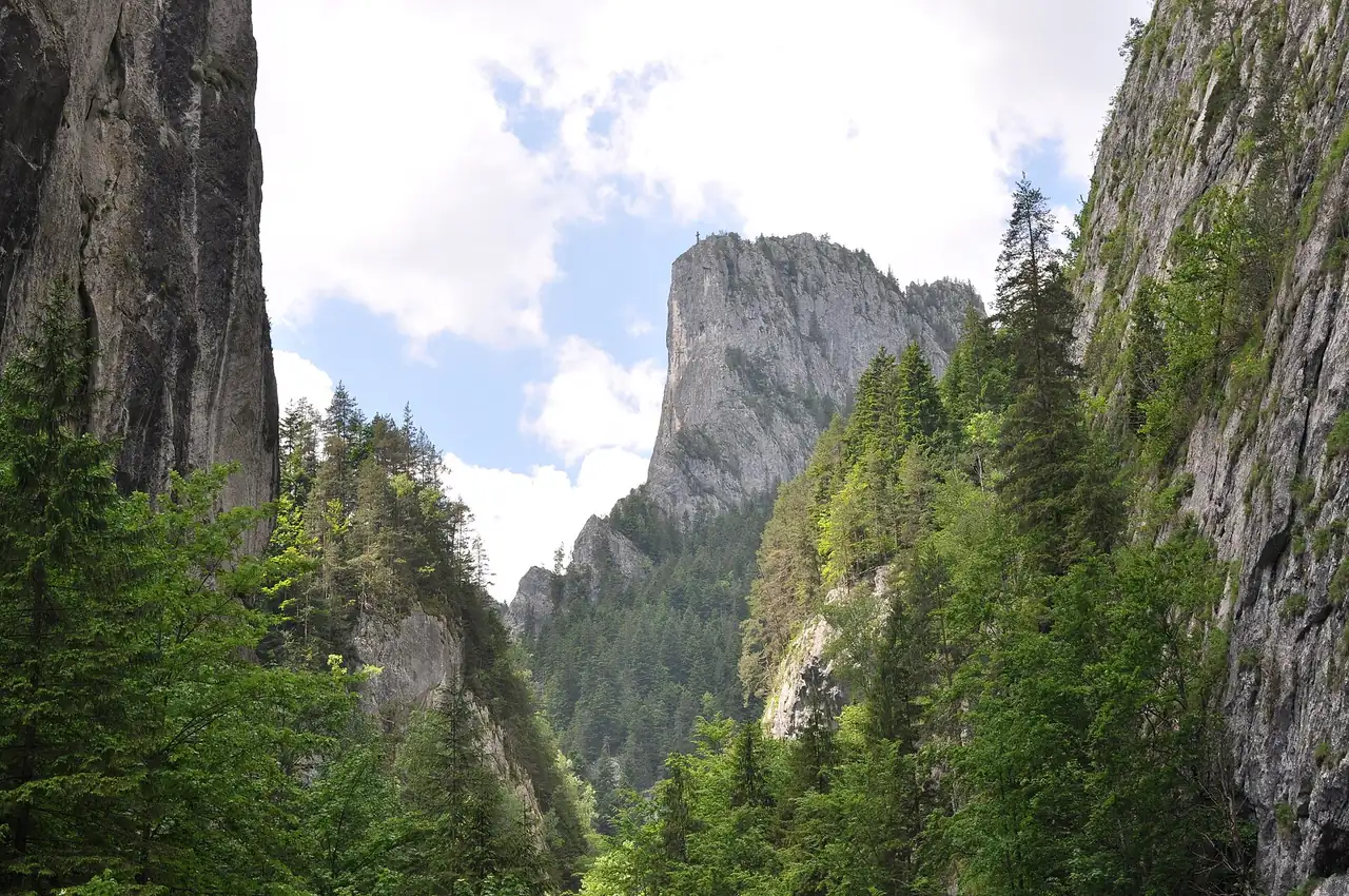
The single most photographed thing here is Piatra Altarului, the Altar Stone, a 1,154-metre limestone tower standing free in the middle of the ravine. Worth knowing before you plan anything around it: there’s no walking route to the top. It’s one of the few summits in Romania reachable only by a climbing route, and the way down is by rappel. From the road you look at it, and that’s the whole relationship.
The kiosks, the rockfall and where to actually stand
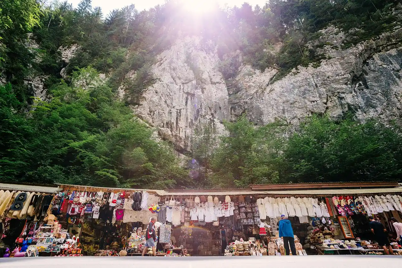
A long strip of wooden stalls runs along the base of the cliff on the Neamt side: sheepskin waistcoats, ceramics, wooden spoons, honey and a fair amount of imported tat. It is the busiest and most convenient place to stop, and it sits directly under the overhang.
On the night before 14 April 2026, rock came down onto the carriageway at exactly the point where those kiosks begin. Crews cleared it through the following morning while county police held the area, and the warning issued afterwards was aimed at pedestrians rather than drivers: the risk stays high for anyone who stops and walks close under the rock face.
That wasn’t a freak event. In January 2025 an expert survey commissioned by the national roads company identified eight zones of major rockfall and treefall risk inside the gorge. The favoured fix is anchored steel mesh across the rock face plus flexible catch barriers, with a 65-metre gallery proposed for the worst sector; sprayed concrete was rejected on environmental grounds. Design was meant to become construction from 2026.
The practical version: buy your ceramic pot, then photograph the wall from the far side of the road rather than standing beneath it. And if you’re the sort of driver who stops wherever the view opens up, resist it here. Laybys are few, several are unmarked gravel, and a car on a blind bend in a gorge this narrow endangers everyone behind it.
The road’s own recent history
DN12C has had a rough two years, and the detail matters if you’re planning a crossing rather than a day out.
By the end of May 2025 it was already coming apart. At kilometre 33+940 a large retaining wall had gone into the Bicaz river, the stone parapet was leaning, a cavity had opened under the shoulder and 20 metres of carriageway had sunk. Four hundred metres on, fast water had shoved the concrete parapet outwards and left a void of more than 21 metres. Above all of it hung the loose rock at a spot named Piatra Pantirului, which the local commune warned could let go at any moment. The county emergency committee banned vehicles over 13 tonnes for thirty days, and then the autumn rains set off fresh landslides on the same stretch.
Repairs finally ran from May 2026: road structure rebuilt, retaining walls reconstructed. The regional roads directorate, DRDP Iasi, declared the work finished and traffic restored without restrictions on 25 July 2026. Read that carefully, though. The slope at Piatra Pantirului was kept under observation during the works rather than made safe, and nobody has signed off the risk of blocks coming away from that face.
Treat that as a snapshot rather than a promise. This is a gorge road under active geology, it has closed and reopened repeatedly, and a diversion costs two hours because the alternatives run right around the massif. Fifteen minutes on Romanian road news before you commit is cheap insurance.
Driving it isn’t technically hard: narrow, busy in July and August, and mixed traffic of coaches, motorbikes and tourist cars stopping without warning. Winter is a different animal. The road stays open all year but wants a properly shod car, and heavy snowfall can shut it. Our guide to driving in Romania covers the rovinieta, fuel and the rest.
Lacu Rosu is not red
The lake sits at the Transylvanian end, somewhere between 938 and 983 metres depending on which survey you read, covering about 11.5 hectares and roughly 10 metres deep at most. In 1837 a flank of Mount Ghilcos slid into the valley and dammed the stream, drowning a spruce forest as it filled. The stumps still stand out of the water, grey and bleached, and they are why the lake photographs like nowhere else in Romania.
The name is a small trap. In Romanian it is Lacu Rosu, the Red Lake, after the reddish iron-rich alluvium the Red Creek carries into it. In Hungarian it is Gyilkos-to, the Killer Lake, either after the same mountain, whose Romanian nickname Ucigasul also means the killer, or after the local story of shepherds and flocks drowned by the landslide. Arrive expecting red water and you’ll be disappointed: sediment has pushed the colour to green and blue, and the red tint mostly shows at sunset.
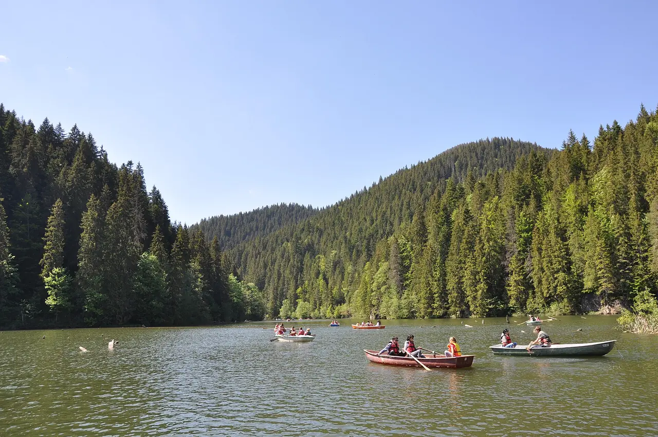
The silting is a real problem rather than a cosmetic one. The check dams built upstream to trap sediment went roughly two decades without being cleared, and every year of that shaved depth and surface off the lake. The rescue plan has changed hands rather than stalled: announced in 2021, folded into Romania’s EU recovery plan, then lifted back out of it in May 2026, when the environment ministry listed Lacu Rosu among five water projects moved onto the national budget instead. Works are meant to run during 2026, no completion date has been published, and I’d treat any you’re quoted as provisional. Meanwhile the lake stays smaller and shallower than the postcards suggest.
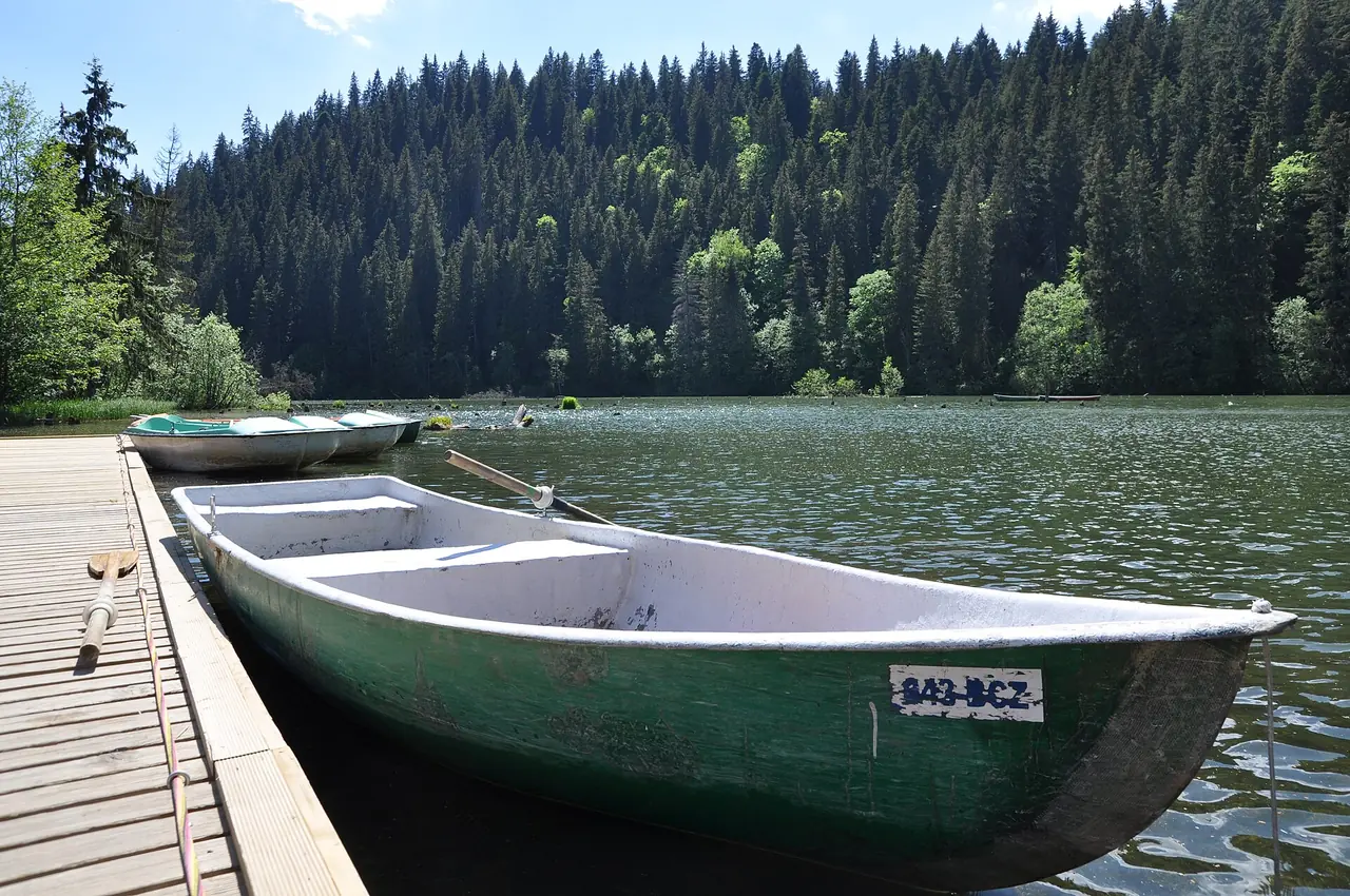
Rowing boats go out from the jetty on the north shore, and half an hour among the stumps is the best money you spend here. Romanian guides quote around 40 lei a head for 2026, older visitor reports say less, and nobody publishes a tariff, so take cash and ask at the pontoon: you’re paying whatever the boatman says on the day.
An hour round the lake, or three hours up the ridge
The lakeside circuit is 3.5 km with 40 metres of climb, marked with a red cross, walkable in an hour and open all year. Flat, easy, and it’s what most visitors do.
The better walk goes up. Suhardul Mic takes two to three hours for about 370 metres of ascent and puts you on the balcony above the water, the view every aerial photograph of the lake is imitating. Suhardul Mare is around three hours and 524 metres. Longer options: the Lapos Canyon circuit, 5 km and 425 metres of climb in about three hours, and the Bicajel gorge trail, four to five hours, with a suspension bridge slung high across the ravine. The park keeps 18 marked routes, signposted from the lakeside road and from the gorge.
Boots, not trainers. The limestone is polished slick where thousands of feet have crossed it, and in early spring the upper paths hold ice into mid-morning. If you’re building a walking trip rather than a drive-through, our Carpathian hiking guide covers the seasons, the huts and the bear etiquette.
Getting there, with a car and without
By road the lake is 25 km from Gheorgheni, about half an hour, and 31 km from the town of Bicaz through the gorge, closer to 45 minutes with traffic. Piatra Neamt is around 58 km and an hour and twenty. From further out: Brasov 182 km and a bit over three hours, Suceava 154 km and three and a quarter, Iasi 186 km and roughly three and three quarters, Cluj-Napoca 240 km and just under four, Bucharest 360 km and the best part of six.
Without a car you can still reach it from either side, and the timetable rather than the distance decides your day. From Gheorgheni, on the Transylvanian side, nine minibuses a day run to the lake for 19 to 20 lei in 29 to 34 minutes (Irina Trans, Alex Tour, Lazar Trans Neamt). The catch is the first departure: 13:20, which puts a morning arrival from that side out of reach. The Moldavian side is the early one, eight a day from Bicaz town from 07:20 for the same money and the same half hour, nine a day from Piatra Neamt from 07:00, from 34 lei, a shade under an hour. Nearest stations are Gheorgheni, Bicaz and Piatra Neamt. Checked on autogari.ro for 3 August 2026; times move with the season.
Here is what the timetable hides. Those Bicaz and Piatra Neamt runs drive the full length of the gorge to reach the lake, so you do see it, through a minibus window, with no stop at Gatul Iadului and no chance to stand under the walls. If the ravine is why you’re coming, drive it yourself, westbound and early, before the coaches build up.
Do not confuse it with the other Bicaz lake
Two lakes near Bicaz share a name in casual use, and booking the wrong one is a classic mistake. Lacu Rosu is the small natural one described above, up the gorge. Lake Izvorul Muntelui, usually called Lacul Bicaz, sits a few kilometres north of Bicaz town on the Bistrita: the largest artificial lake on Romania’s inland waters, 40 km long and up to 97 metres deep behind a 127-metre dam built between 1950 and 1960 for the Bicaz-Stejaru power station. Both are worth an hour, and they are 30 km and one gorge apart.
Fitting it into a real trip
Time of day matters here more than the number of hours you block out. Between roughly 11 and 4 in July and August the stall strip and the coach parties turn the narrow section into a shuffle; the first two hours after sunrise are quiet, the light comes down the walls instead of flattening them, and there is somewhere to leave the car. Three hours from the first hairpin to the last coffee covers the drive, the stalls, a boat and the lake circuit without any of it feeling like queueing.
The rest is arithmetic, and it points one way: this is a crossing, not a destination. From the west, our Transylvania road trip route finishes at the eastern edge of the province, and DN12C is the natural way off the end of it. Heading east, ten kilometres of rock drop you out of Transylvania into Moldavia, with the painted monasteries of Bucovina about three and a half hours on and Iasi three and three quarters. Put the gorge in the middle of a driving day and it is one of the two or three best hours of road in the country. Build a day around it and you spend six hours in a car for eight kilometres of limestone.
Photos
On the map
The map loads on click - to keep the page lightweight.
The map didn’t load. Check your connection and refresh the page.
Admission and opening hours
- Admission price
- Not free, whatever most write-ups say. The park administration's approved 2026 visiting tariff is 10 lei for adults and children over 14 and 5 lei for children under 14, sold through its own site (cheilebicazului-hasmas.ro, checked 3 August 2026). DN12C itself is a public national road with no barrier, so driving the gorge costs only fuel and parking. Rowing boats on Lacu Rosu are quoted at around 40 lei per person by Romanian guides in 2026, but no operator publishes a tariff, so treat that as an estimate. Some laybys charge for parking and some do not: carry small notes in lei.
- Opening hours
- The road and the lakeside path are open around the clock, all year. Boat hire, the kiosks and most lakeside restaurants are seasonal; in March roughly half of them are shut.
DN12C reopened without restrictions on 25 July 2026 after consolidation work at Bicaz Chei. Rockfall is a live hazard on this road, not a theoretical one: check Romanian road news before committing to a long detour.
Details checked: August 3, 2026
Distance
- Bucharest ≈360 km · about 5 h 30 - 6 h by car; there is no direct bus or train
- Cluj-Napoca ≈240 km · about 3 h 50 by car via Toplita and Gheorgheni
Read also

What to see · 11 min read
Marginimea Sibiului: Shepherd Villages Near Sibiu
Verified · September 5, 202618 shepherd villages west of Sibiu: Rasinari, Sibiel glass icons, Saliste, Paltinis bus fares, and how a day out of town works.

What to see · 9 min read
Prejmer Fortified Church: UNESCO Near Brasov
Verified · September 3, 2026Prejmer fortified church 15 km from Brasov: Greek-cross plan, 275 wall rooms, UNESCO hours for 2026 and how a visit actually works.

What to see · 11 min read
ASTRA Museum Sibiu: Romania's Great Open-Air Village
Verified · August 29, 2026ASTRA Museum near Sibiu: 50-lei tickets, hours by season, how to get there, and which of the 400+ buildings across 96 hectares to see first.

What to see · 10 min read
Bucegi Sphinx & Babele: Cable Car from Busteni
Updated · August 26, 2026Ride the Busteni cable car to the Sphinx and Babele: 2026 return fare 199 lei, hours from 08:30, and how to pair it with Peles or Cantacuzino.