
Transfagarasan Road 2026: Open Dates & Status
Open on 23 September 2026 but running in winter conditions up top, and the alpine section can shut any day from 20 October - the rule and your plan B.
The Transfagarasan is a 151 km mountain road, the DN7C, that climbs to 2,042 m across the Fagaras range between Sibiu and Pitesti, and the single most important thing to know is that its high section is only open for a few months a year. It reopened on 12 June 2026 and was still open on 23 September, but that morning DRDP Brasov had two ploughs out and over five tonnes of salt down at Balea Lac after heavy overnight snow, and DRDP Brasov said the difficult conditions would hold for the following days. There’s no fixed 2026 closing date yet - by rule the alpine stretch between Piscu Negru and Balea Cascada can shut any day between 20 October and 30 June once the weather turns, and last year it closed right on 20 October. Turn up after the barrier comes down and you’ll hit a locked gate partway up; there’s no way through the closed section itself, just the cable car to Balea Lac from the still-open north side, or the Olt valley road further west if you need to cross the mountains entirely (more on both further down).
This page is about the road itself: when it opens, what you actually see, and how to drive it without the mistakes that catch first-timers. For the wider Transylvania loop it belongs to (Brasov, Bran, Sibiu, the vignette, the logistics), see the Transylvania road trip guide. And if you would rather walk the range than drive it, our Carpathian hiking guide covers the Fagaras ridge on foot.
Drive it in July, August or the first half of September for the safest odds, start early to beat the coaches, fill the tank at the bottom because there’s no fuel at the top, and take it slowly on purpose. The switchbacks are the point, not an obstacle between you and the summit.
Want both legendary passes in one loop? Our Transfăgărășan and Transalpina route strings DN7C and DN67C from Sibiu.
When is the Transfagarasan open?
In practice from early or mid-June - 6 June in 2025, 12 June in 2026 - until the road authority shuts it for winter, which by rule it can do on any day from 20 October onwards. None of this is improvised. Normativ AND 615-2020, the standing regulation CNAIR and the regional DRDP Brasov road authority work from, closes the alpine section between Piscu Negru in the south and Balea Cascada in the north for the whole 20 October to 30 June stretch, and the same text is why the road runs 07:00-21:00 rather than around the clock: night traffic over the pass is banned outright. Both the closing and the reopening wait on a special inspection by a CNAIR commission, so the date is announced, never scheduled in advance. And driving past a closed barrier is not a cheap mistake: the road code turns it into a 60-day suspension of your right to drive in Romania, and it applies to foreign licences too.
The recent pattern runs wider than the rule on its own suggests. In 2025 the road opened on 6 June, snow shut the top from 8 October and the winter closure became official on 20 October; in 2024 it opened on 7 June and stayed open all the way to 12 November. Snow this early in the season is not unusual up here either: about 3 cm fell on 20 September 2022 with temperatures below -3 C, the first snow of 2025 came on 29 September, and 2024 had its own late-September winter. From 20 October the road authority runs extra daily inspections on the section to decide whether to close it.
The practical rule: if you’re travelling in June or after mid-September, treat the pass as a maybe and have a plan B. Check the Infotrafic bulletins from the Romanian Police in the days before you drive, along with CNAIR and DRDP Brasov press releases - not a blog post from two summers ago, and not this page either, since the decision can land with a day or two of notice. If you’re still fixing your dates, our best time to visit Romania guide sets this opening window against the ski season, the delta and the coast so the whole trip lines up. When the barrier is up, the road runs daily between 07:00 and 21:00, and the gates really do come down for the night, so a sunrise start is the difference between an empty road and a crawl behind tour buses.
What is there to see along the road?
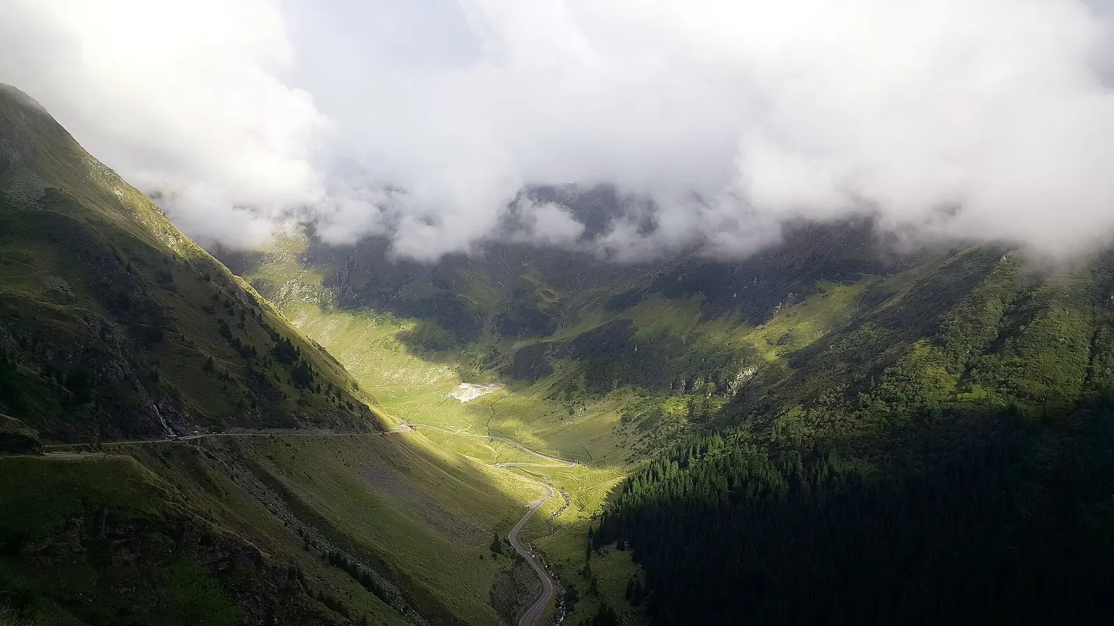
The drive stacks up its best moments in the northern half, above Sibiu. Coming from Cartisoara you climb through forest to the Balea waterfall (Cascada Balea), a long cascade tumbling from around 1,200 m, with the lower cable-car station beside it. Push on up the hairpins and you reach Balea Lake (Balea Lac), a glacial tarn at roughly 2,034 m cupped in bare rock, ringed by cabanas and, in July, wildflowers and lingering snow patches. Right by the lake the road ducks through the Balea tunnel, about 884 m long, emerging on the southern side at the 2,042 m high point.
South of the tunnel the character changes. The descent is longer and greener, and after about 50 km it reaches Lake Vidraru and its 1960s arch dam, a huge concrete curve wedged between cliffs. Just below that stretch, Poenari Castle sits on a ridge reached by about 1,480 steps - a natural stop if you’re already on the southern half. This southern half stays open all year, so even in winter you can drive up to the dam from Curtea de Arges; it’s only the alpine crown that shuts. Most day-trippers from Sibiu or Brasov turn around at the lake and never see Vidraru, and the southern descent feels emptier for it and, on a clear afternoon, arguably better.
Why is a road this remote here at all?
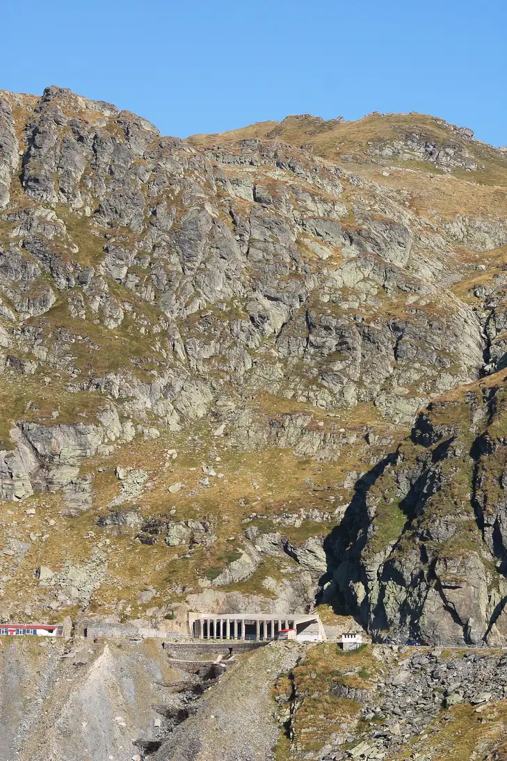
Because a dictator was afraid of tanks. Nicolae Ceausescu ordered the Transfagarasan built between 1970 and 1974 after the Soviet invasion of Czechoslovakia in 1968 spooked him into wanting a military route straight over the mountains, one his own armour could use if Moscow’s ever rolled in. The work fell largely to army conscripts, and it was brutal: roughly six million kilograms of dynamite were used to blast the route through solid rock. The official toll is 40 soldiers killed, though unofficial estimates run into the hundreds. In one July 1970 incident, seven were crushed by a rockfall while sheltering from a storm.
It found a very different kind of fame in November 2009, when Top Gear filmed a supercar run over the pass and Jeremy Clarkson called it “the best road in the world” on air. The label stuck, and so did the crowds; on a fine summer weekend the top can feel more car park than wilderness. That history is worth carrying with you, because the sheer improbability of the road is half of what makes driving it feel like a stunt.
How do I actually drive it? The traps to avoid
None of the driving is technically hard, but three things quietly ruin people’s day.
First, fuel. There’s nothing at the summit and nothing for a long way down the far side. Fill up in Sibiu or, at the latest, at Cartisoara at the foot of the northern climb; from the south, top up around Curtea de Arges. Running the tank low on the way up is the classic rookie error.
Second, speed and the crowd on the road. Forget the national 90 km/h limit up here; the hairpins are signed at 40 km/h or less, and you’re sharing them with cyclists grinding uphill, pedestrians drifting into the road for photos, and slow campervans. The reward for patience is that you get to look at one of the great mountain roads instead of your bumper.
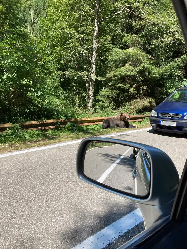
Third, bears. This isn’t a novelty warning. Brown bears are common along the treeline, and CNAIR explicitly cautions drivers about them; feeding one carries a fine of 10,000 to 30,000 lei. Don’t stop to photograph a bear from an open window and never offer food. Enjoy them from inside a closed car and move on. Tourists do get hurt here: on 8 June 2026 alone, three people were injured in two separate incidents on this road, both after stopping for a bear, which is why it heads the list in our guide to whether Romania is safe.
On the paperwork side, you’ll need a valid rovinieta road vignette, which almost every rental car already includes; the details of hiring a car, the deposit and insurance excess are in our car rental in Romania guide, and the practical vignette-and-distances rundown lives in the Transylvania road trip page. Most people rent in Brasov or Sibiu, the natural bases for the pass rather than Bucharest.
Can I see it if the road is closed?
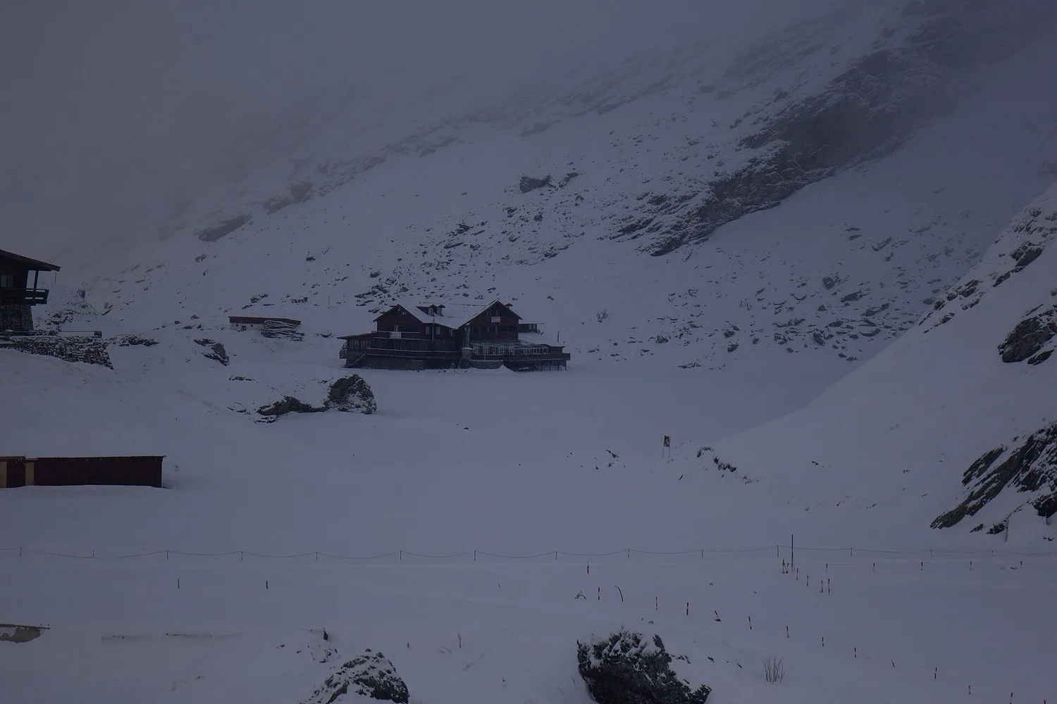
Yes, partly. When the top is shut for snow you can still drive up the northern half to the Balea waterfall, park, and take the cable car (telecabina) the last stretch to Balea Lake. The lift climbs about 3,700 m of cable from the lower station at 1,200 m to the lake at around 2,040 m, takes roughly 15 minutes, and runs 09:00-18:00 in summer and 09:00-17:00 in winter, with the last car up at 16:30 and no service in bad weather. A one-way adult ticket is 80 lei, around 15 euro; children aged 2 to 12 pay 40 lei and under-2s travel free, and a return is 160 lei for an adult, 80 for a child. Two conditions are worth knowing before you build a day around the lift, because neither is obvious from the bottom station. The cabin only leaves once ten passengers have gathered, which is quick on a busy summer day and slow out of season, exactly when the road is shut. And tickets are sold at the boarding stations only, cash or card, so there’s nothing to book online in advance. In deep winter an ice hotel is built beside the frozen lake, rebuilt each year from blocks cut out of Balea itself, reachable only by that cable car. So a February trip to the summit is possible; you just leave the car below and ride up. If you actually need to cross the mountains rather than just see the lake, there’s no way through the closed section - loop around via the Olt valley road (DN7) through Ramnicu Valcea, or via Brasov and the Prahova valley toward Bucharest.
Which direction, and how long does it take?
If you’re basing in Transylvania, drive it from the north: start at Cartisoara off the DN1 near Sibiu, climb to Balea, and either turn around at the lake or carry on south over the tunnel toward Vidraru and Curtea de Arges. Taken as a there-and-back from Sibiu to the lake and home, budget a full day with stops, not a couple of hours; the road is short in kilometres but slow by design. If you cross the whole 151 km south to Pitesti, you’re committing to a one-way traverse and a long loop back, which only makes sense if Bucharest is your next stop anyway.
The most common plan is a day trip from Sibiu or Brasov: leave at dawn, be at Balea Lake before the coaches, walk the lake, then descend before the afternoon light and traffic thicken. If the hairpins aren’t something you want to take on yourself, a private day trip with a driver turns the pass into a sit-back day and lets everyone watch the scenery instead of the road. Either way, sleep the night before somewhere near the foot of the mountains; our Sibiu travel guide and things to do in Brasov both set up good bases, and the pass slots neatly into the wider 7-day Romania itinerary.
Drive it once and you understand the fuss. Time the season, respect the bears, fill the tank, and let the road be slow. The Transfagarasan does the rest.
Route day by day
- Days on the road
- 1
- Distance
- ≈151 km
- Budget from
- Road free; cable-car return 160 RON per adult
- Best season
- July, August, September
The route at a glance
-
Cartisoara (north foot)
Route startstop ≈20 min
The northern start off the DN1 near Sibiu. Last reliable fuel before the climb - fill the tank here.
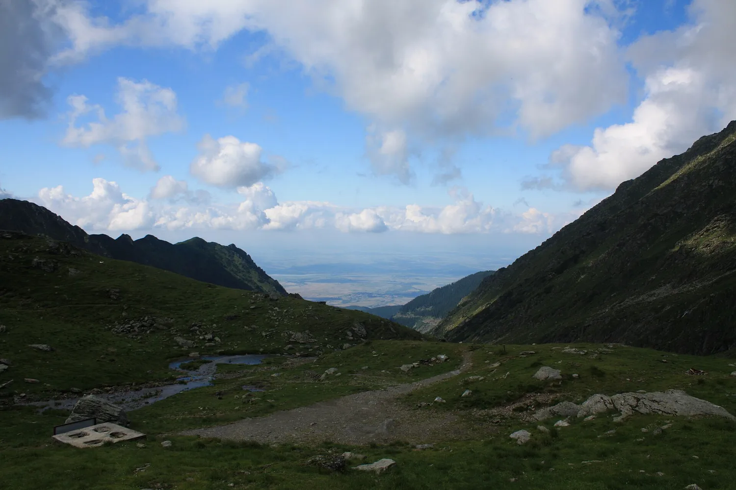
Photo: Mercy / Wikimedia Commons, CC BY-SA 3.0 ( source) -
Balea Cascada (waterfall)
23 km from the startstop ≈45 min
The Balea waterfall and the lower cable-car station at ~1,200 m. The telecabina runs up to the lake even when the top of the road is shut.
Photo: Dioszegi Zoltan / Wikimedia Commons, CC BY-SA 4.0 ( source) -
Balea Lac (summit tunnel)
34 km from the startstop ≈90 min
The high point: a glacial lake at ~2,034 m and the Balea tunnel, at 2,042 m the top of the whole road. No fuel, thin air, sudden weather.
Photo: Eugene Zaycev / Wikimedia Commons, CC0 ( source) -
Piscu Negru (south of the pass)
47 km from the startstop ≈15 min
The southern end of the alpine section that closes in winter. Below here the DN7C stays open year-round.
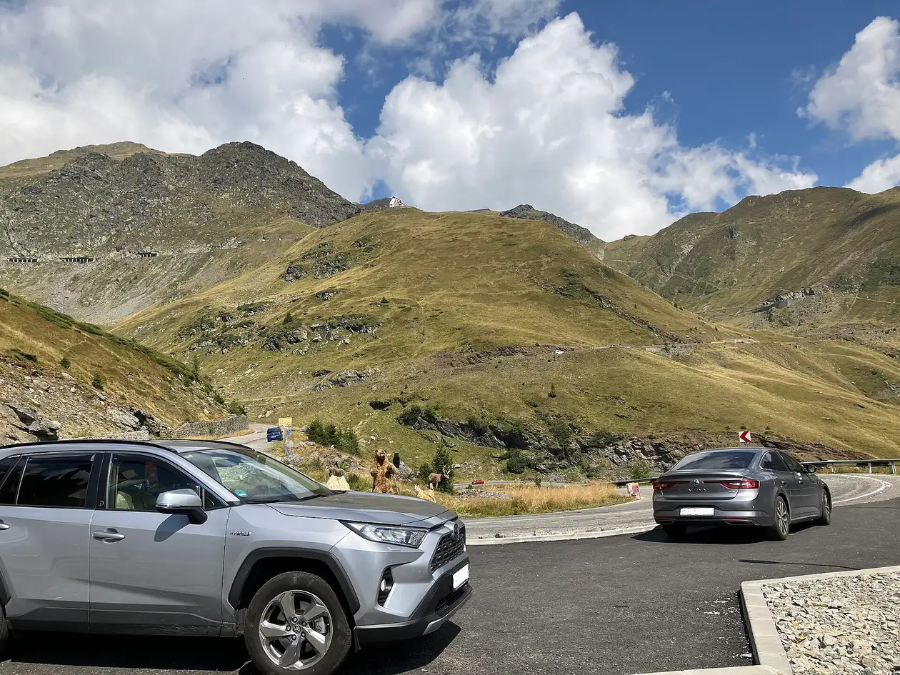
Photo: Stoschmidt / Wikimedia Commons, CC BY-SA 4.0 ( source) -
Vidraru Dam
96 km from the startstop ≈40 min
A 1960s arch dam holding back Lake Vidraru, the scenic anchor of the southern half.
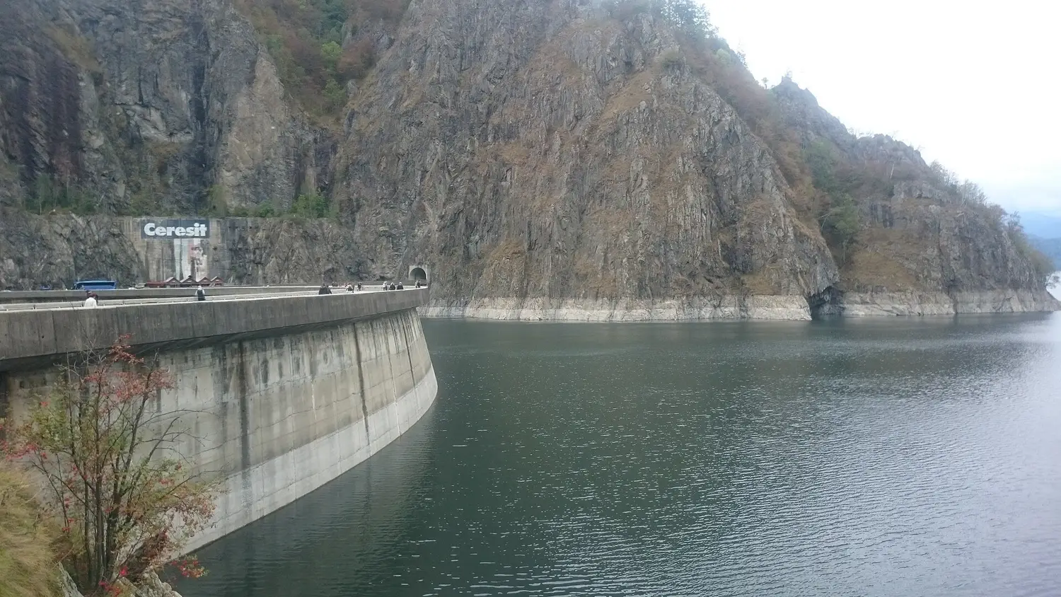
Photo: DariDaryk / Wikimedia Commons, CC BY-SA 3.0 ( source) -
Curtea de Arges (south end)
151 km from the startstop ≈30 min
Where the mountain road spills onto flat Wallachia near Pitesti. The full DN7C runs about 151 km end to end.
Route map
The map with stops loads on click - to keep the page lightweight.
The map didn’t load. Check your connection and refresh the page.
Admission and opening hours
- Admission price
- The road is free. Balea cable car (Balea Cascada to Balea Lac): 80 lei one way for an adult, 40 lei for children aged 2 to 12, free under 2; a return is 160 lei. The cabin leaves once ten passengers have gathered, and tickets are sold at the boarding stations only, cash or card.
- Opening hours
- Road open daily 07:00-21:00 in season. Cable car 09:00-18:00 in summer and 09:00-17:00 in winter, last car up 16:30, weather permitting.
The alpine section (Piscu Negru to Balea Cascada) can shut any day from 20 October to 30 June, depending on the weather. On 23 September 2026 it was still open, but DRDP Brasov had two ploughs and over five tonnes of salt out at Balea Lac that morning and DRDP Brasov said the difficult conditions would hold for the following days, so take a car that is ready for snow. Check the Infotrafic updates from the Romanian Police on the morning you drive.
Details checked: September 23, 2026